Buying or selling acreage near The Dalles feels different from a standard in-town home sale. You are not just pricing a house. You are weighing water rights, usable acres, access, and the real value of barns and infrastructure. If you understand how appraisers look at these pieces, you can set better expectations and avoid surprises. This guide explains what drives value on rural parcels around The Dalles and how you can prepare for a smooth appraisal. Let’s dive in.
What appraisers look for on acreage
Appraisers rely on established standards and local market evidence to value rural property. The process is structured, but the data can be thin in rural markets, so preparation matters.
Core valuation approaches
- Sales Comparison Approach. For rural residential acreage near The Dalles, this is the primary method when there are adequate comparable sales. The appraiser adjusts recent sales for differences in acreage, water, location, outbuildings, and access.
- Cost Approach. This supports the analysis when homes, shops, or barns are newer or specialized. The appraiser estimates replacement cost, subtracts depreciation, and adds land value.
- Income Approach. If the land produces measurable income, such as leased pasture, an orchard, or irrigated crops, an income method can be used with market capitalization rates.
Appraisers complete their work under the Uniform Standards of Professional Appraisal Practice. If you want the technical foundation, review the standards from The Appraisal Foundation. For methodology background, the Appraisal Institute offers additional guidance on rural valuation.
Highest and best use
The appraiser determines the property’s most likely legal, physical, and financially feasible use. Around The Dalles, this may be rural residential, continued agricultural use, or, at the urban edge, land with potential for future development. Proximity to I‑84, city services, and zoning can shift value segments.
Water rights and irrigation value
In Oregon, water rights are separate real property interests. Appraisers verify the existence, priority date, source, point and place of use, and any delivery systems. Irrigated acres typically command a premium over dryland when supply is reliable and infrastructure is in place.
What to have ready for the appraiser:
- Water right certificates or claims and any transfer history.
- Well logs and any pump test reports.
- Irrigation district membership, delivery details, and recent assessments.
- Notes on the irrigation system, such as pumps, pivots, or laterals, and maintenance records.
You can confirm records through the Oregon Water Resources Department.
Usable acres, soils, and topography
Gross acreage is not the same as usable acreage. Steep slopes, rock, wetlands, or inaccessible pockets reduce the portion that contributes to value. Soil quality and drainage also influence both agricultural potential and development costs.
Appraisers often reference the USDA’s NRCS Web Soil Survey to identify soil types, septic suitability, and erosion risks. If you have a recent survey or sketch that clarifies buildable or farmable areas, share it. It helps the appraiser model the market behavior accurately.
Access, utilities, septic, and wells
Access and services can create material value differences between parcels that look similar on a map.
- Roads and access. Public road frontage is typically more marketable than private or seasonal access. Recorded easements and road maintenance agreements matter.
- Utilities. Parcels closer to The Dalles with potential connection to municipal services often see higher demand. In rural Wasco County, private well and septic are common. Connection costs at the urban edge can be significant and affect value.
- Health and safety. Lender-financed sales require systems that meet minimum standards. The appraiser notes well and septic type, visible condition, permits, and ages.
For zoning, septic permits, and land use, visit the Wasco County official site.
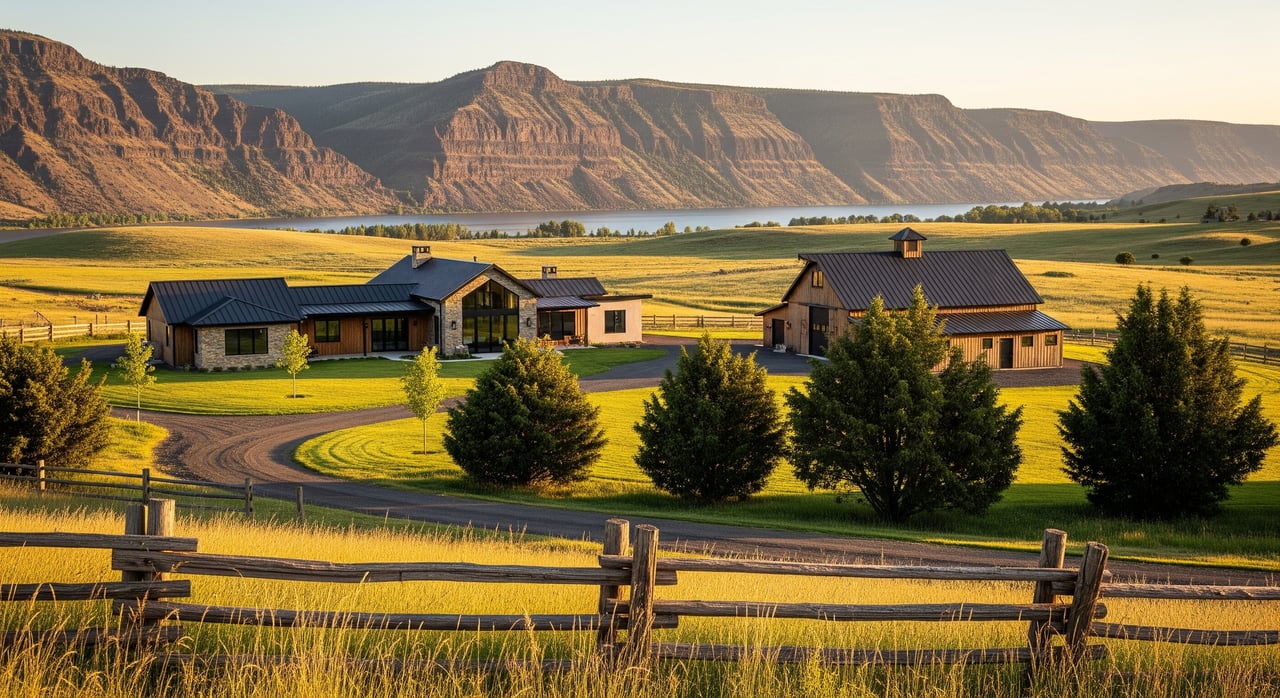
Outbuildings and on-site infrastructure
Barns, shops, equipment sheds, livestock shelters, greenhouses, and irrigation infrastructure can add meaningful value when they are functional and aligned with buyer demand.
How appraisers quantify contributory value:
- Cost approach. Replacement cost new minus physical and functional depreciation, then added to land value.
- Market extraction. Comparison to sales with similar buildings to isolate what buyers are paying for that feature.
- Utility check. Buildings that are obsolete, in poor repair, or highly specialized may contribute little and sometimes detract due to removal or repair costs.
Provide permits, contractor invoices, photos, and maintenance notes for any improvements. Clear documentation supports better-supported value conclusions.
Environmental and hazard factors
Environmental and risk designations can affect both value and insurability.
- Floodplain. Check your flood status with the FEMA Flood Map service. Flood zones can reduce marketability and increase ownership costs.
- Wildfire risk. Rural areas in the wildland urban interface may carry higher insurance costs and stricter defensible space expectations. Local sources and state tools can help you understand the risk.
- Easements and leases. Utility corridors, wind leases, or other encumbrances can affect market perception. Share copies of any recorded documents.
Location adjustments around The Dalles
Location is more than distance. Around The Dalles, market segmentation is common.
- Proximity premiums. Shorter commutes to services, employment, and schools increase demand for nearby parcels compared with remote tracts.
- Utilities at the edge. Access to municipal water or sewer versus private systems can create a price step.
- Amenities and externalities. Columbia River Gorge views, trail access, or proximity to recreation can add appeal. Traffic noise, industrial uses, or transmission corridors can reduce it.
Appraisers derive location adjustments from actual sales evidence, not rules of thumb. Expect your appraisal to show paired comparisons that isolate distance, utility availability, or view influence whenever the data allow.
How appraisers make adjustments
When perfect comparable sales are scarce, appraisers use several techniques to isolate value differences.
Paired-sale analysis
The appraiser compares two otherwise similar sales that differ in one key feature, such as paved versus gravel access, or irrigated versus dryland. The price difference suggests a market adjustment for that feature. Where ideal pairs are not available, the appraiser may analyze clusters of sales and apply supported ranges.
Per-acre pricing behavior
Per-acre price often declines as parcel size increases. A small hobby-farm tract can sell at a higher per-acre rate than a large agricultural holding. Appraisers model this either with size adjustments or by segmenting the market by likely use.
Outbuildings and infrastructure
Expect a combination of cost analysis and market extraction. A well-maintained shop with power and a concrete floor often contributes more than an older, specialized structure in disrepair. Maintenance records help the appraiser calibrate depreciation.
Irrigation and water rights
For productive farms and irrigated acreage, appraisers may compare irrigated versus non-irrigated sales or, in some cases, analyze income from crops using market capitalization rates. The premium depends on supply certainty, delivery costs, and cropping options.
Seller checklist to speed your appraisal
Bring clarity to the appraisal with complete, organized records. You will reduce follow-up questions and support a stronger report.
- Legal: deed, legal description, plat or recent survey, and a sketch of usable acres.
- Taxes: property tax records and any farm or forest special assessment paperwork. Learn about programs through the Oregon Department of Revenue.
- Water: water right certificates or claims, transfer history, well logs, pump tests, irrigation district membership and assessments.
- Improvements: age, permits, and maintenance records for the house, outbuildings, septic, well, roofs, and major systems.
- Access and restrictions: recorded easements, road maintenance agreements, CC&Rs, and any leases such as grazing or wind.
- Environmental: any flood, wetland, or environmental reports you have on file.
Buyer tips to avoid surprises
You can position your offer and due diligence to align with how appraisers view rural property.
- Confirm water early. Verify any water rights through the Oregon Water Resources Department and collect well and irrigation records.
- Understand usable acres. Review soils on the NRCS Web Soil Survey and consider a site visit to note slopes, rock, or drainage.
- Check access and utilities. Ask for recorded road and utility easements and estimate connection costs if near city services.
- Consider risk and insurance. Use the FEMA Flood Map service to check flood status and talk with your insurer about wildfire exposure.
- Align expectations on outbuildings. Focus on function and condition rather than assumed replacement cost.
When data are thin
Rural markets around The Dalles can have few recent, truly comparable sales. In those cases, appraisers may rely on a broader geographic set of sales, larger adjustments, and supplemental methods like cost analysis. They also disclose any data limitations in the report. If you provide high-quality documentation and practical context for your property, you help the appraiser build a stronger case from the available evidence.
Local resources for your file
- Standards and methods: The Appraisal Foundation and the Appraisal Institute
- Water rights and wells: Oregon Water Resources Department
- Zoning, permits, and records: Wasco County
- Soils and usable acres: NRCS Web Soil Survey
- Flood maps: FEMA Flood Map service
- Tax programs: Oregon Department of Revenue
Whether you are preparing to list your acreage or making an offer, understanding how appraisers handle water, usable land, access, and improvements gives you an edge. If you want a local partner to help you gather the right documents, interpret market signals, and position your property for a smooth appraisal, connect with Tiffany Hillman. You will get hands-on guidance rooted in Wasco County experience and a plan that fits your goals.
FAQs
How do appraisers value irrigated acres near The Dalles?
- Appraisers compare irrigated and non-irrigated sales and may use income methods for productive farms. Premiums depend on supply certainty, delivery costs, and crop options.
Do barns and shops always add value on rural parcels?
- Functional, well-maintained buildings with market demand contribute value. Very specialized or deteriorated structures can add little and sometimes reduce value due to repair or removal costs.
Will being closer to The Dalles increase my acreage value?
- Often yes. Proximity to services, shorter commutes, and potential access to municipal utilities increase demand. The exact adjustment depends on local sales evidence.
What if there are few comparable sales for my property?
- Appraisers may use a broader radius, larger adjustments, and supporting methods like cost analysis or paired sales. They disclose data limits and rely on the best available evidence.
What documents should I gather before the appraisal?
- Deed and survey, tax and special assessment records, water right and well documents, permits and maintenance records for improvements, access agreements, and any leases or environmental reports.